
Rockwall ZIP Code Candidates and Their Local Use
Rockwall research identifies 75032 and 75087 as the working postal candidates for a Rockwall city page. That is a starting set, not a claim that each code falls wholly inside the city or that every Rockwall address uses only one of them. The United States Postal Service remains the delivery authority for a particular Rockwall address, while the Rockwall City GIS layer, Rockwall RCAD record, city limits, ETJ, and Rockwall County maps answer different geographic questions.
| ZIP | Postal and geographic context | Rockwall directory treatment | Address-level check |
|---|---|---|---|
| 75032 | Standard Rockwall mailing ZIP that can also be used for nearby Fate or Heath addresses, depending on the street. | Primary Rockwall city-page candidate, not a city-limit label. | Confirm the completed Rockwall address through USPS, then compare parcel geography in GIS or RCAD. |
| 75087 | Standard Rockwall mailing ZIP that can also be used for nearby Fate addresses. | Primary Rockwall city-page candidate, subject to address-level confirmation. | Use USPS for the mailing line and Rockwall City or Rockwall County sources for political and parcel context. |
USPS ZIP Code Lookup provides the operational address check shown in the source image below. It is the right first stop for a delivery ZIP, but it does not replace the Rockwall parcel or city-boundary review.
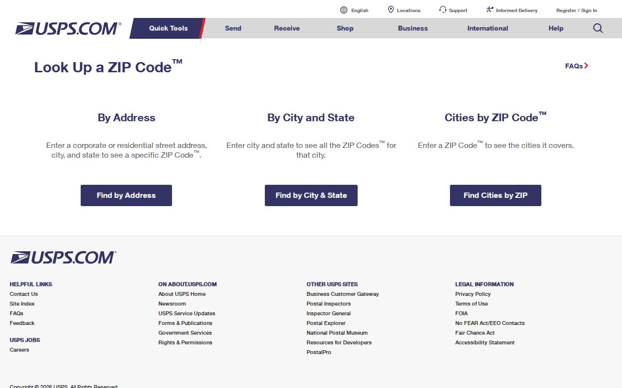
Record the postal city and ZIP returned for the exact Rockwall address, including any accepted alternate city name. Then keep that postal result separate from the property’s Rockwall municipality or location inside a city’s ETJ.
Verify a Rockwall ZIP Code Before Reading Parcel Records
Begin with the printed Rockwall street address, retain the original form, and let USPS normalize the delivery line. Once a full Rockwall address has a postal result, Rockwall RCAD can connect it to the tax and appraisal context and Rockwall City GIS can connect it to mapped parcel geography. Neither system is a citywide household register. An owner mailing address may belong to a lender, trust, company, tax representative, or prior owner, while a situs address identifies the property location.
Rockwall County Development Services lists GIS and 9-1-1 addressing contacts at 1101 E Yellowjacket, Suite 130, and Rockwall County provides a 9-1-1 Addressing Application. Use the Rockwall County authority for a new or changed rural or County 9-1-1 address and Rockwall City for municipal GIS or building context. For a Rockwall boundary parcel, confirm responsibility with both. The research found no verified citywide quadrant or renumbering guide, so this directory does not assume a numbering rule.
Postal versus parcel clue. A ZIP is a delivery geography. A legal description, parcel, GEO ID, city limit, school district, or floodplain overlay answers a different Rockwall location question.
The Rockwall ZIP Code Directory: What Local Portals Actually Filter
Several Rockwall tools can help after a postal result, but none is a Rockwall resident roster filtered by ZIP. Rockwall RCAD’s inspected form accepts account, owner, mailing address, property location, account type, active or inactive status, and paid or unpaid status. It did not expose a ZIP field. The official voter lookup is for an individual Rockwall registration check, not a ZIP-wide list. Rockwall City GIS can browse spatial layers, while its REST route is geometry and attribute based rather than a people directory.
| Source and field path | What the researched interface supports |
|---|---|
| USPS address lookup | Address-level delivery formatting and ZIP verification for a specific mailing address. |
| RCAD property search | Account, owner, mailing address, property location, account type, active or inactive, and paid or unpaid fields; no inspected ZIP field. |
| Rockwall City GIS | Parcel and map-layer browsing with geometry and attributes, including address, street, subdivision, zoning, floodplain, district, and other mapped layers where available. |
| Texas voter lookup | VUID, a Texas driver-license number when supplied to registration, or first and last name; it is not a ZIP-wide voter roster. |
| Texas ClaimIt | Last or business name and first name, with optional city, property ID, and current ZIP. Claim ownership and documents are private. |
The RCAD property-search page illustrates the local field model. Search a verified address through the property-location route, or use a name variant only as a separate lead.
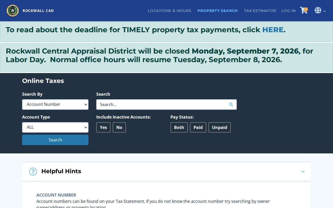
The Rockwall RCAD result can provide legal description, GEO ID, appraisal and inspection context, and a mailing-versus-situs distinction. Its online coverage cutoff was not located in official sources, so label each Rockwall result with the tax year and source-checked date rather than assuming a universal cutoff.
Finding Residents by a Rockwall ZIP Code
A Rockwall ZIP narrows an address question, then the next Rockwall source should be chosen for its own record type. Do not expect a search to identify everyone in a delivery area. The following sequence uses the ZIP as a geographic check, then moves to the Rockwall parcel, record, or voter route that is actually available. This avoids turning a postal field into a claim about current residence.
- Enter one complete Rockwall address in USPS and save the returned city and ZIP with the lookup date.
- Search Rockwall RCAD by the property-location field or account number. Retain the parcel’s GEO ID, legal description, and tax year, not a bare owner-name match.
- Open the Rockwall City GIS map or parcel layer to check the address or geometry against Rockwall city limits, subdivision, and other mapped overlays.
- When a Rockwall voter question is appropriate, use the Texas person lookup or a properly narrowed Secretary of State request. Exclude protected and suppressed fields.
- Use the Rockwall County Clerk, Rockwall City, or state custodian for a defined follow-up record identified by a case number, parcel, instrument, or date range.
Once a verified ZIP narrows the task to a particular address or street segment, the Rockwall street directory offers the detailed address-keyed chain of parcel, GIS, deed, and permit sources.
Use Rockwall Map Layers to Separate ZIP Code and City Lines
Rockwall’s geography adds Rockwall overlays that a postal result cannot settle. A delivery address may use “Rockwall” as its postal city while lying outside Rockwall city limits, or it may fall within a Rockwall City or Rockwall County boundary while USPS prefers another city name. Fate, Heath, Royse City, Rowlett, Wylie, and Forney-area postal geographies should be mapped separately from the Rockwall city page. The Rockwall City limits and ETJ brochure is a dated visual reference, not a substitute for an address-level legal determination.
The City GIS map service shows the layer structure available for parcel and location context.
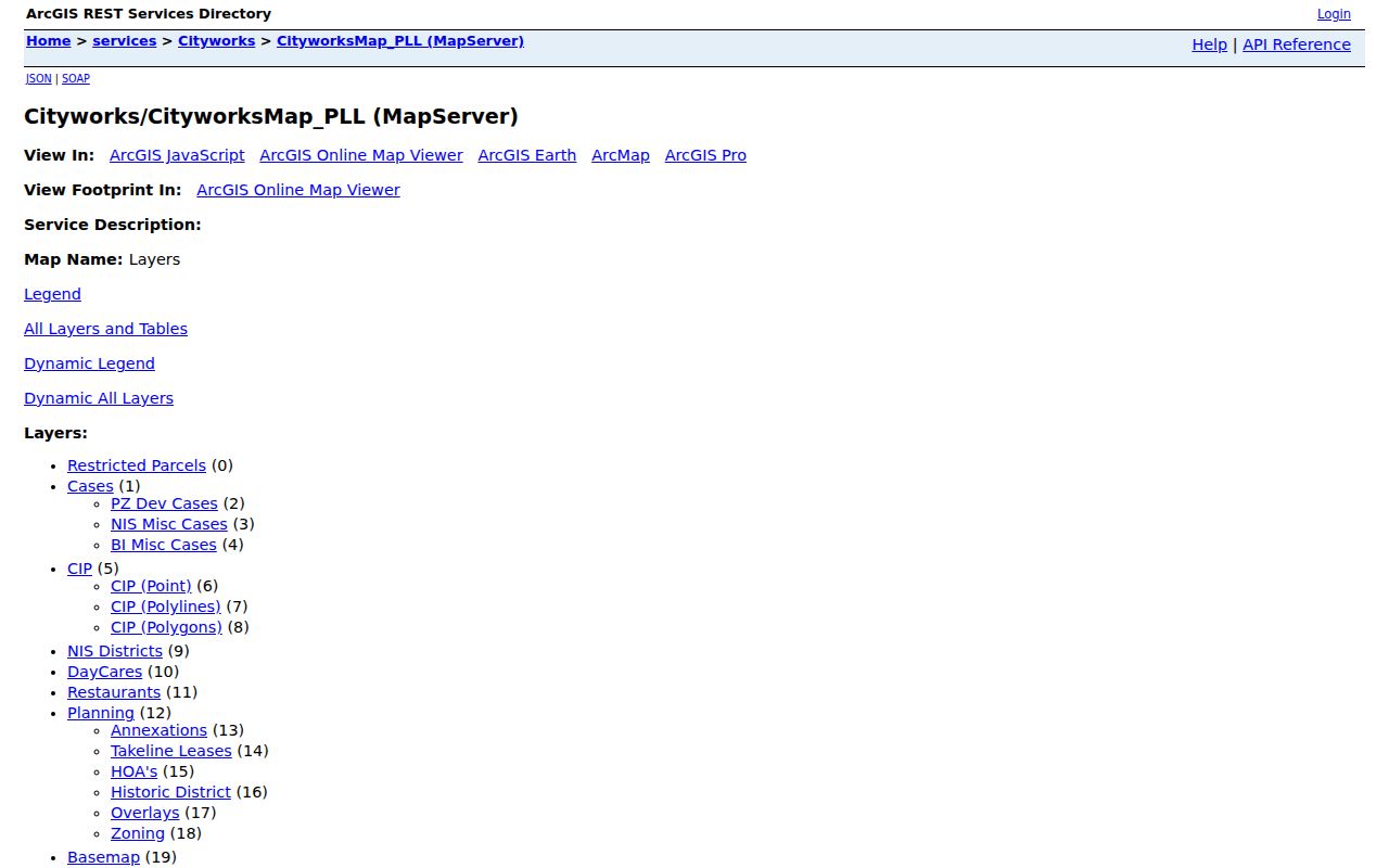
Use a Rockwall GIS result to document the query date, parcel or prop_id, layer URL, and displayed fields. The Rockwall map disclaimer still matters because mapped accuracy and update times vary. A Rockwall map association label does not prove membership, household identity, dues status, or current occupancy.
Rockwall’s Lake Ray Hubbard setting, Old Town history, city limits, ETJ, and parcel layers make this a records-geography question as much as a postal one. The city’s 2020 population and 2025 estimate describe service context, not the identity or status of any individual address.
Nearby Rockwall ZIP Codes Belong in County Context
Some surrounding codes touch Rockwall County geography or appear on a broad Rockwall map, but the research does not treat them as default Rockwall city codes. Keeping them separate prevents a ZIP search from drifting into neighboring communities. USPS decides the postal line for a specific address; Rockwall County maps, Rockwall RCAD, and Rockwall GIS decide the parcel and jurisdiction context.
| Nearby ZIP | Research description | How to present it |
|---|---|---|
| 75088 and 75089 | Rowlett-area ZIPs touching County geography. | Adjacent context, not a default Rockwall city result. |
| 75132 | Fate PO Box or area ZIP. | County-wide ancillary context, not a Rockwall city default. |
| 75189 | Royse City-area ZIP. | County-wide ancillary context, not a Rockwall city default. |
| 75098, 75126, 75135, and 75160 | Wylie, Forney, Quinlan, and Terrell-area boundary context. | Do not place them in a Rockwall city result without address-level evidence. |
No official source in the research established a Rockwall ZIP split or realignment year, a unique single-institution ZIP, a PO-box-only Rockwall ZIP, or complete per-ZIP voter-registration statistics. Those remain gaps to verify rather than facts to infer from a map.
Use a Rockwall ZIP Code as a Postal Field, Not a People Roster
Texas voter lookup is person and registration oriented. VoteTexas documents lookup by VUID, a Texas driver-license number when it was supplied to registration, or first and last name. A Rockwall result may show registration status, County, precinct, districts, and limited address display, but it is not proof that a person is physically present now. The automated research session could not inspect all current controls, so a Rockwall portal result should retain the official date and exact labels shown.
For a lawful voter-file request, the Secretary of State public-information form asks for requester contact information, a precise description, medium, and format. Texas Election Code chapter 18 supplies timing, reproduction-cost, notice, and use rules. Rockwall Elections is the local verification route, while the statewide route does not authorize a public ZIP-wide display of protected information. The County’s 2024 privacy notice says polling locations are not on turnout rosters or cast-vote records and ballot images are redacted.
Note: Protected voters, Address Confidentiality Program participants, and suppressed address fields remain excluded even when another records system shows a matching name.
Rockwall ZIP Code Boundaries and City Limits Answer Different Questions
Rockwall postal delivery, municipal authority, and parcel geography must be read side by side. A Rockwall postal label can serve a nearby address, and a parcel near a Rockwall city line may require Rockwall City and Rockwall County confirmation before a jurisdiction conclusion is made. The Rockwall City brochure’s two-mile ETJ note reflects a historical population bracket and should not be treated as a current legal conclusion. Confirm a current legal boundary with the responsible Rockwall City or Rockwall County office.
- ZIP versus ZIP+4
- A ZIP identifies a delivery geography. ZIP+4 adds a more specific delivery segment, so a ZIP+4 result should not be treated as a neighborhood or municipal boundary.
- PO Box ZIP
- A ZIP used for post-office boxes describes mail pickup rather than the location of a street-address parcel.
- Unique ZIP
- A code assigned to one organization or location. No Rockwall example was established in the researched official sources.
- Carrier route
- A postal delivery grouping that helps route mail. It is not a public list of people or a political district.
Address privacy. Do not use a ZIP, parcel map, voter clue, or mailing line to identify a protected physical address or to contact, stalk, or harass a person.
Refresh Rockwall Postal and Parcel Sources at the Address Level
A practical source note for a Rockwall address should say what was checked and when: USPS for postal formatting, RCAD for appraisal or tax context, City GIS for parcel or overlay context, and the correct custodian for any later record. If a map source is used, retain the layer URL and query date. If an RCAD field is used, retain the tax year. If a portal’s cutoff is not documented, say “coverage cutoff not located in official sources.”
Source checked September 1, 2026. The research does not claim a current ZIP-wide resident roll, a complete ZIP-level voter count, or a universal alignment between postal city and Rockwall municipal limits. That restraint is useful: a precise address check is more reliable than a broad ZIP assumption.