
Trace a Rockwall Street Directory
An address is a join key, not a person. Begin with the street number and name, then confirm how the place is identified in the appraisal and map systems. Rockwall Central Appraisal District, known as RCAD, supplies the appraisal account, tax-record owner field, situs address, legal description, and GEO ID. The GEO ID is a geographic identifier that helps connect a parcel across records. City GIS then puts that parcel on the map. The County Clerk index follows the legal description and instrument parties. Each source answers a narrower question than a claim about who lives there.
- Use the RCAD property search with the property location. Its help says to omit the street type and direction, such as entering a number and street name rather than a fully styled address.
- Open the same location in the City of Rockwall GIS maps. Compare the street address, parcel geometry, prop_id, subdivision fields, and visible layers.
- Write down the legal description and GEO ID. A legal description identifies land by lot, block, survey, or metes and bounds. It is more durable than a street label.
- Search the County Clerk property-record route by the legal description, instrument parties, and date range. Read the deed image or office copy before treating an index entry as a transfer.
- For an older address trail, pair maps, tax material, and newspapers with the historical collections described in the Rockwall directory book. No verified Rockwall city-directory run was located in the research, so record the title and year before relying on a directory entry.
Keep the version of the address that each record prints. A parcel can have a situs address, an owner mailing address, a legal description, an RCAD account number, and a GIS or utility address record. They can agree, but they are not interchangeable. If an address is near a city line, check the city-limit, ETJ, county, school, and fire layers separately. Postal formatting also requires address-level confirmation rather than an assumption based on the word “Rockwall.”
Note: The online OPR portal is an access copy, and its current online coverage cutoff was not located in official sources.
RCAD Fields for Rockwall Streets
RCAD is the address-research starting point because its form has concrete address and owner controls. It is an appraisal and tax record, not a resident register. An owner may be a trust, estate, business, lender, or former owner. A tax mailing address can be elsewhere. Record the tax year and any active or inactive status before comparing accounts, especially when a parcel has been split or changed.
| RCAD field | How to use it | Important limit |
|---|---|---|
| Search By and Search | Choose account, owner, owner address, or property location; owner names follow the “Doe John” pattern. | A name can match more than one person. |
| Account Type | Separate real, personal, mineral, or other account categories when the form exposes them. | Category is not a household label. |
| Include Inactive Accounts | Check whether a result is active or historical before carrying it forward. | Inactive does not explain why an account changed. |
| Pay Status | Use Both, Paid, or Unpaid only as a search filter. | Do not turn tax status into a description of a person. |
| GEO ID and legal description | Use these as cross-source keys for GIS, plats, and deed research. | Confirm against the current record and map date. |
The RCAD search screen shows the fields used for this Rockwall address workflow.
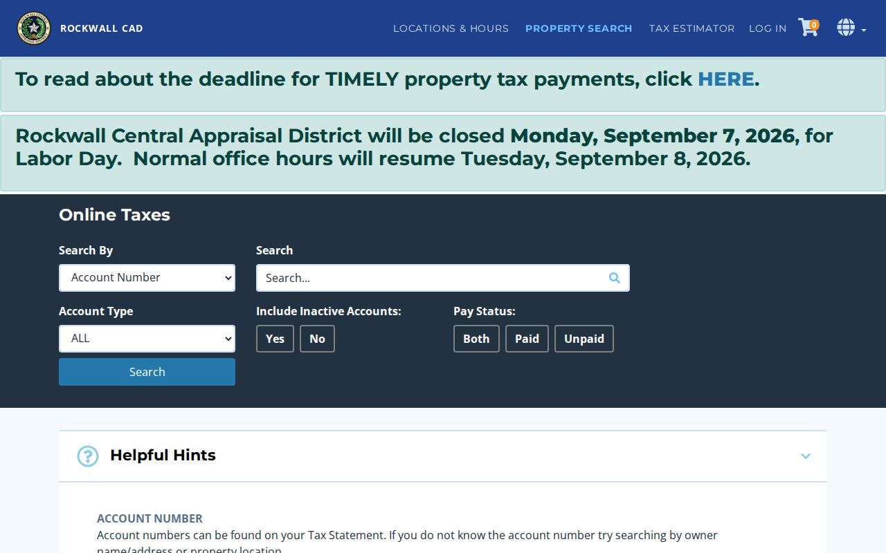
The form supports a reproducible search note: enter the property location as searched, retain the result date, and compare the account with the parcel layer instead of relying on a name alone.
Rockwall Street Parcels and GIS
City GIS makes the appraisal record spatial. Start on the address or street map, click the parcel, then follow its prop_id or parcel hyperlink to available attributes. The public layers can show parcels, addresses, streets, subdivision plats, zoning, historic districts, annexation, floodplain, school and fire districts, utilities, and case layers. Layer dates and mapped accuracy vary, so save the layer URL, query date, and returned parcel ID with any result.
A parcel layer can include corrected owner-mailing fields, parcel-use categories, subdivision status, floodplain flags, and created or edited metadata. Those are research fields, not evidence of current occupancy. The City’s GIS disclaimer matters most where a street approaches an ETJ or city boundary. Use USPS for delivery formatting, RCAD for the appraisal account, and the responsible city or county office for a legal jurisdiction question.
The City GIS layer service exposes the source layers used to place an address in its parcel and jurisdiction context.
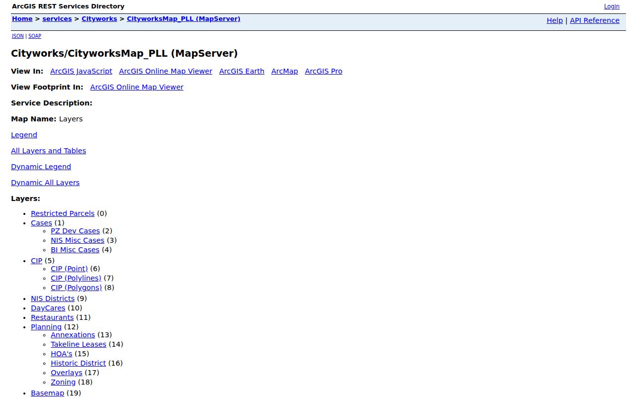
Use a layer’s date and purpose beside the address. A zoning, floodplain, utility, or planning layer adds context to a parcel, but it does not identify a current household.
Rockwall Street Records by Address
Several Rockwall record sets can be keyed to an address, but each has a different scope. The property account links to a legal description. GIS links to map geometry. A deed or plat documents an instrument or subdivision. A permit records an application or inspection event. Election information has separate access rules and protected-address limits. Chaining these sources is more reliable than treating any one of them as a complete street-by-street household list.
| Address record | Rockwall keeper | What it can show | Access route |
|---|---|---|---|
| RCAD appraisal | Rockwall Central Appraisal District | Account, owner or tax mailing field, situs, legal description, values, exemptions, and appraisal dates. | Online RCAD search; cutoff not located. |
| Parcel GIS | City of Rockwall | prop_id, geometry, subdivision or floodplain context, parcel use, and layer links. | Map and ArcGIS REST query. |
| Recorded deed or plat | Rockwall County Clerk | Instrument parties, filing details, legal description, and lot, block, or phase. | Tyler, office copies, or historical microfilm. |
| Permit or inspection | City Building Inspections | Work type, site or parcel, dates, status, plans, fees, and inspections. | CityWorks account and periodic reports. |
| Planning or code case | City Planning/GIS | Case number, type, status, year, comments, and parcel context where shown. | GIS layer and available case documents. |
| Voter record | Texas SOS and Rockwall Elections | Registration information only as permitted by election law. | Person lookup or formal file-request route with protections. |
- Parcel
- A mapped unit of land, commonly tied to an appraisal account and GIS geometry.
- Situs address
- The location assigned to the property itself. It can differ from a tax mailing address.
- Plat
- A recorded subdivision or boundary document that can supply a phase, block, lot, and filing reference.
- Criss-cross directory
- A street-order directory section, if a verified volume includes one. No Rockwall run or criss-cross section was confirmed in the research.
Carry the same GEO ID or legal description from RCAD to GIS and the Clerk index. A street name alone can change, be abbreviated, or cover several parcels. The stronger link is the parcel identity plus an instrument or map date.
Rockwall Permit Trails by Street
The City’s Building Inspections CityWorks portal requires an account and offers permit, certificate of occupancy, plan, review-comment, fee, and inspection functions. The city also posts issued-permit reports for 2016 through 2025 and periodic 2026 reports. Use the live portal for later status, but preserve the report period when reading a PDF. A report row may include a permit number, application and issue dates, type, status, site address, parcel number, subdivision, valuation, square footage, fees, and inspection-related contacts.
Those fields create a chronology of property activity. They do not establish that an applicant, contractor, or contact controls a property or lives there. A case layer is likewise a record of a case type and stated status, not a final finding. For a focused public-information request, name the department, address or parcel, record type, date range, and preferred delivery instead of asking for an open-ended person search.
Note: CityWorks uses an account login, while an issued-permit report is a dated snapshot rather than a live status screen.
Rockwall Deeds Behind a Street
The deed chain should begin with the current legal description or GEO ID, not just an owner name. Search the County Clerk index for that description or the current grantee, inspect the purchase instrument, then work back by searching the seller as an earlier grantee while carrying the same lot, block, phase, or metes-and-bounds language. A metes-and-bounds description uses survey calls and boundaries instead of a subdivision lot and block. A plat often bridges a new street address to its recorded subdivision description.
The County says its public Tyler database is not the official repository and may not be complete or unaltered. If a needed image is not available online, use the Clerk office or courthouse access route rather than treating a negative web result as proof. The published copy pricing is $25 for the first page and $4 for each additional page; the County lists separate pricing for plats and other records. Ask the office whether a plain or certified copy is appropriate for the purpose.
The Rockwall County Property Records page explains the OPR route, copy options, and published fee information.
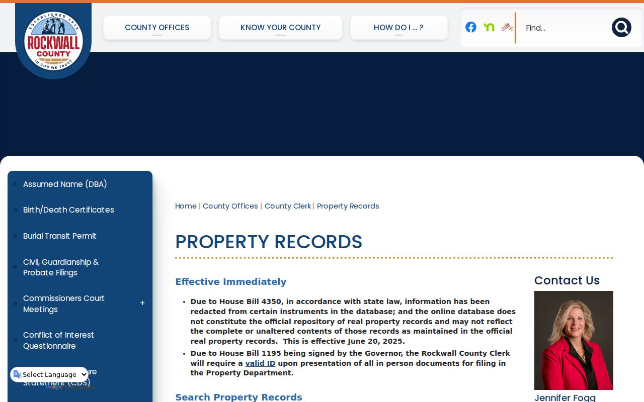
Use the image as a wayfinding aid, then confirm a fee and availability with the Clerk because the request type, page count, and current office schedule can affect the result.
Historic Rockwall Streets in Context
Older street research needs more than today’s map. The official historic-map collection includes a 1905 downtown-business map, a pre-1950 city map, 1912, 1954, and 1963 USGS maps, and an interactive historic district. Compare each map by date and purpose. A historic street line can help locate an older address form, but it does not settle a current boundary or parcel question.
For deeper house history, pair the map with a plat, deed index, tax-roll context, and newspaper notice. The county’s early record trail is uneven because the first courthouse burned in 1875 and the stone records annex burned in 1892. Kaufman-transcribed deeds for 1848 to 1873, Rockwall deed records from 1873 to 1901, and local microfilm are reconstruction leads. A missing record from one source is especially weak evidence for the oldest addresses.
Rockwall Street Boundary Checks
Rockwall’s February 2025 limits and ETJ brochure is a dated visual reference, not a substitute for address-level jurisdiction confirmation. Its city-limits and ETJ boundaries sit beside different postal, county, school, fire, and parcel overlays. The working Rockwall ZIP candidates are 75032 and 75087, but USPS determines delivery formatting for a complete address. Nearby municipal and ETJ context can produce a Rockwall postal line without placing the parcel inside city limits.
Use a simple order: confirm the printed address with USPS, compare the RCAD account and GIS parcel, toggle the relevant boundary layers, then ask the responsible city or county office about a boundary-specific question. The County Development Services and 9-1-1 addressing contacts handle county addressing questions, while City GIS provides municipal map context.
Rockwall Street Nearby Parcels
Nearby means spatially adjacent parcels, not a social relationship. In the GIS map, note the subject parcel’s prop_id and geometry, then inspect touching parcels or run a documented distance or intersection query. The REST layers support queries, ordering, pagination, and geometry or distance parameters, with a 1,000-record maximum noted for the parcel and HOA layers. A reproducible result records the layer URL, query date, subject geometry, relationship method, and returned parcel IDs.
The Rockwall parcel layer is the official source behind an adjacent-parcel check.
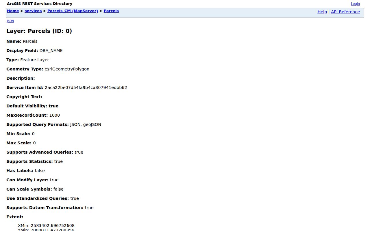
A mapped association or nearby parcel is not evidence of membership, household identity, ownership, or a personal relationship. Keep parcel facts, history, and association labels separate.
Rockwall Street Research Gaps
Several useful cutoffs remain unverified. The research did not locate an OPR online imaging cutoff, an RCAD tax-roll cutoff, a verified citywide street-renumbering guide, a confirmed Rockwall city-directory run, or a specific Rockwall Sanborn item in the inspected Library of Congress results. Those gaps matter because an address can disappear from one source while remaining traceable through another.
When a key record is missing, use the access channels that fit the record type: County Clerk or courthouse access for an instrument, the library’s Genealogy and Periodical Room for microfilm, TSLAC holdings for historical reels, City GIS for layers, or a bounded Texas Public Information Act request for an existing city record. State the source and date used rather than filling a gap with an unsupported match.
Rockwall Street Search Limits
A street search cannot prove every person at an address. GIS and RCAD are parcel systems. A recorded deed identifies instrument parties, not current occupants. A permit applicant or contractor may have a role in property work without being an owner. The public voter lookup is person and registration oriented, and a full voter file follows separate Texas election procedures with protected-voter and suppressed-address rules. Utility customer lists are not a public resident source.
Protective rules also apply to recorded documents. Rockwall County cites Texas Property Code §11.008 and Texas Government Code §§552.117 and 552.1175 for certain redaction matters, and its current notice references HB 4350. Do not copy protected addresses, Social Security numbers, driver-license numbers, or protected official or victim information from a record.
Lawful use. Use Rockwall address records for personal, lawful research and confirm important facts with the custodian. Never use an address trail to stalk, harass, intimidate, or harm anyone.